Thursday, May 26, 2016

Greece overview FINAL BLOG POST


Greece is located between Italy and Turkey in the middle of the Mediterranean Sea. It sits right on the Aegean plate and is specifically located on the Hellenic Volcanic arc. This places Greece in a hot spot for volcanic activities and costal hazards. Greece does have a main land but it is also has a series of islands, and many of those, if not al of these island are volcanoes, So these major hazards and disasters go hand in hand with each other.

Another problem the Greek islands face in their series of volcanoes. The country sits right along the "Aegean Volcanic Arc" which is caused by the seduction of the African under Eurasian plate is what caused these volcanoes to form.  Due to the activity and high-pressure volcanoes swarm the Mediterranean Sea mostly located right in the heart of Greece.  There are over 100 volcanoes in Greece, though some have gone extinct. There 6 main volcanoes in Greece which are Sousaki, Methana, Milos, Nisyros, Kolumbo and the biggest of then all, Santorini. As Volcano Discovery puts it "It is a very complex stratovolcano dominated by a large, sea-flooded caldera created by several large explosive eruptions." This has the largest crater in the world though it is sunken in the sea. Santorini has had small eruptions in recent years but no major eruptions.

Greece is known for the beautiful turquoise and crystal clear waters. According to the CIA World Factbook, Greece has 13,676 kilometers (8,498 mi) of coastline, the largest in the Mediterranean Basin. Greece has a total of 2,000 Greek islands but only 168 are inhabited. Majority of the large cities in Greece are located in what is considered a costal zone, this includes 80% of industrial activity and 90% of tourism and recreation. This means that 33% of all the population lives on the coast of Greece.  Majority of the coast is rocky cliffs, which can effect how the waves crash. Though every factor contributes to what the ocean is like, Greece's shores remain calm majority of the time. 

Greece has sensors places on the sea floor to monitor volcanic activity in the ocean as well as energy levels under water. They were strategically placed around the island and at the middle of the Santorini crater.  According to Greek Island Travel "The 24-member research team is also using two submersibles for deep-sea dives in order to gather detailed information on the structure of the Santorini caldera."  This shows that they do try to be prepared for these types of events. I think that an App would be a very helpful tool for those living in dangerous areas or even those who plan to travel to the area. If you can imagine, it would be something similar to amber alerts. Involuntarily it makes your phone notify you that there is a series danger near you. It could warn people of harmful volcanic activity, tsunamis, dangerous storms, or coastal problems and many more. Also I think that News alerts do help. For those that do not have access to television and cell phones, local loud sirens to warn towns could also save many lives. As far as what is already out there, surfline is very accurate as well as NOAA. Both of these sites can help to be prepared for what is coming.

When I was told to pick a country to focus my study of each topic of this class it was a hard choice for me. After careful consideration I decided on Greece. I picked this country because it is one of my top travel destinations. Before I started my studies I truly knew nothing about the land, or especially nothing about the hazards and disasters. Like I mentioned before Most of the cities in Greece are located in what is called the “costal zones” and the islands them self are giant volcanoes. Santorini in my opinion is the most beautiful of the larger cities though it is not the safest. I would definitely try to make this island safer. This would be would consider my target area. It is a giant volcano and it does experience serious coastal hazards.  Alert systems would help the island of Santorini.

After reading about the negatives and positives of each location, I would choose Athens as the safest place to live. One because is not an island. It is on the main land. Also it is not on the top of a volcano. And lastly, it is not directly next to the ocean, since it is so large has a northern side that is away from the ocean.
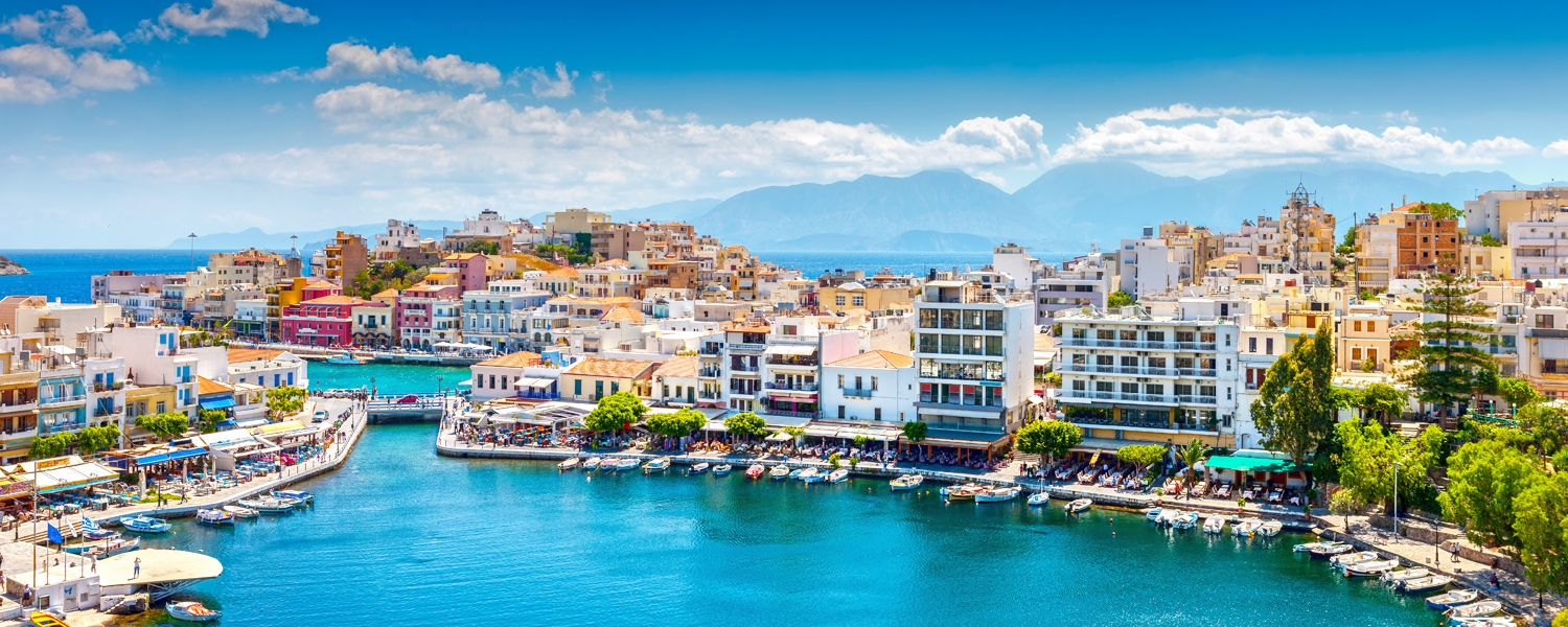
 Image result for greece

REFERENCES 
http://www.volcanodiscovery.com/greece.html
www.flightcentre.com.au
www.manchesterairport.co.uk
http://www.volcanolive.com/greece.html
http://www.volcanodiscovery.com/santorini.html
http://www.greeka.com/greece-holiday/nature/volcanoes/
http://www.volcanodiscovery.com/hellenic-arc.html
http://www.decadevolcano.net/santorini/santorini_geology_geography.htm
https://en.wikipedia.org/wiki/Geography_of_Greece
http://www.climatechangepost.com/greece/coastal-erosion/
http://ec.europa.eu/maritimeaffairs/documentation/studies/documents/greece_climate_change_en.pdf
http://www.visitgreece.gr/en/sea/beaches
http://www.greeka.com/greece-geography/

https://www.researchgate.net/publication/268074280_Coastal_hazard_related_to_landslide_distribution_derived_from_morphotectonic_analysis_SW_Gulf_of_Corinth_Greece

Sunday, May 8, 2016

Coastal Hazards

Greece is surrounded by Coastal shores, which all vary vastly between them. Greece is known for crystal clear waters. According to the CIA World Factbook, Greece has 13,676 kilometres (8,498 mi) of coastline, the largest in the Mediterranean Basin. This is mainly due to the fact that greece has so many islands. Greece has a total of 2,000 Greek islands but only 168 are inhabited. 

Climate Change Post says "The coastline of Greece is 15,000 km long (60% mainland, 40% islands). Four coastal types have been recognized (2): hard rock coasts (44%), soft rock or conglomerates cliff coasts with pocket beaches (14%), beach zones (36%), and mud coasts (6%).  Sediment supply to the coast has decreased strongly due to the construction of dams, river channelization and intense coastal development "

Majority of the large cities in greece are located in what is considered a costal zone, this includes 80% of industrial activity and 90% of tourism and recreation. This means that 33% of all the population lives on the coast of greece. For those Visiting the area have the opportunity to explore many kilometers of bays, coves, sand dunes, pebble beaches, caves, volcanic soils all located on the shores.  Majority of the coast is rocky cliffs which can effect how the waves crash. Though every factor contributes to what the ocean is like, Greece's shores remain calm majority of the time. 


In most of my research i could not find any solid information on how they handle costal disasters. According to ec.europa.eu The main actors involved at the national level are the Ministry of Environment, Physical Planning and Public Works, the Ministry of Mercantile Marine and the Ministry of Economy and Finance. Funding for coastal protection projects is mainly provided by European programmes. Municipalities carry out coastal protection projects to the extent they receive sufficient financial means by the state or the EU." They seem to be focused on the research to fix costal problems but they do not handle current situations as they should. Surf line is a great app that shows surf updateds all over the world. This may help to be prepaid for damage that a large swell could bring with it. Also i think a active travelers blog could help tourists be prepared  for whats to come, considering that majority people traveling to the area are going for the amazing beaches and coastlines.


https://en.wikipedia.org/wiki/Geography_of_Greece
http://www.climatechangepost.com/greece/coastal-erosion/
http://ec.europa.eu/maritimeaffairs/documentation/studies/documents/greece_climate_change_en.pdf
http://www.visitgreece.gr/en/sea/beaches
http://www.greeka.com/greece-geography/
https://www.researchgate.net/publication/268074280_Coastal_hazard_related_to_landslide_distribution_derived_from_morphotectonic_analysis_SW_Gulf_of_Corinth_Greece

Friday, April 15, 2016

Extreme Weather in Greece

Extreme weather can be a series of different things such as high winds, thunderstorms and extreme heat. It is hard to say the weather for the country as a whole. Even though Greece is a small country, between the islands there can be drastic changes. Overall, Greece has what is to be considered moderate climate. All of the seasons are what they should be but can be very dramatic. Greece is known by tourist to be a tropical warm paradise but that is only partially true in the spring and summer months. Other times of the year it can have extreme rainfall.

As far as extreme weather goes you will not find much of that in the Greek Islands. If you ever plan on visiting Greece many suggest to go sometime from May through August.
 Is said there can be extreme heat waives in the month of July with temperatures reaching 40 degrees (remember they go by celsius).

January of this year Northern Greece experienced a huge storm that came through bringing snow and and extreme winds reaching 10 beaufort! When big storms strike the islands the swell is a big fear. This storm had large waves crashing buildings, causing damage and traffic jams. The large swell caused over 50 boats to over turn. These type of storms typically only occur in the mist of winter.


http://www.lonelyplanet.com/greece/weather
http://greeklandscapes.com/travel/weather.html
https://weather-and-climate.com/average-monthly-precipitation-Rainfall,Athens,Greece
http://www.keeptalkinggreece.com/2012/01/08/extreme-weather-conditions-hit-greece-video-waves-sweep-cars/


picture
http://www.marketwatch.com/story/greece-will-survive-but-will-the-euro-or-the-eu-2015-06-26

Friday, March 25, 2016

landslides in Greece

Landslides in Greece occur for many different reasons. One reason being earthquakes. When the plates shift this causes rocks to break and create landslides. The eastern part of the country are composed of geological formations and tangential movements. Intense folding and and fracturing result in alpine formations. Not only do these natural formation play a major role in landslides, urbanization and development are also a crucial contributing facto to these natural disasters. In a 2 and a half year time span there has been over 250 land slides.

Since 1950 to current day, landslides have been recorded on the relational database management system. Studies have been done to predict future landslides. According to Geosciences "The prediction ability was found to be 75.2% indicating an acceptable susceptibility map obtained from the GIS-based bivariate statistical model". This helps with future preparedness for all the islands. 
 
Weather can also be a huge contributing factor to landslides. Though this can cause large landslides its much easier to be prepared for this type of event.


ISSN 2076-3263
www.mdpi.com/journal/geosciences
http://link.springer.com/chapter/10.1007%2F3-540-28680-2_37#page-1
http://www.sciencedirect.com/science/article/pii/S0013795200000430d

Sunday, March 6, 2016

Greece Volcanoes

Greece is a hot spot for volcanic activity. The country sits right along the "Aegean Volcanic Arc" which is caused by the subduction of the African under Eurasian plate is what caused these volcanoes to form. Many of the most significant volcanoes in Greeks history have gone extinct. However there still are are six different volcanoes: Sousaki, Methana, Milos, Nisyros, Kolumbo and the biggest of then all, Santorini. 

Santorini is seen is the most famous volcano in Greece, due to the fact is such a tourist destination. Santorini is a large group of volcanoes located in the Aegean Sean just south of the Cyclades. As Volcano Discovery puts it "It is a very complex stratovolcano dominated by a large, sea-flooded caldera created by several large explosive eruptions." This also has the largest crater in the world, height of 300m and a diameter of 11km. However, this crater has sunken and has filled with sea water. Santorini was Greece's latest explosion in 1950. in 1613 BC The Minoan Eruption occurred which was the largest in Greece's history, though it was on of the most studied it still remains to be one of the most mysterious irruptions to date.  This may be because the fact that it occurred so long ago. According to Greek Island Travel "Santorini has been active several times in more recent times with many minor and medium-sized eruptions that created the islets of Nea and Palea Kameni inside the caldera. "As of current time Santorini is considered to be dormant. 

Recently, sea-floor sensors were placed at the bottom of the ocean to watch volcanic activity. They were strategically placed around the island and at the middle of the Santorini crater. After placing these here there has been a international team of scientists to watch over the island for safety of the local villagers and travelers. According to Greek Island Travel "The 24-member research team is also using two submersibles for deep-sea dives in order to gather detailed information on the structure of the Santorini caldera." 

They have even created volcano hiking tours for those ambitious enough to explore some of the worlds larges volcanoes. 


http://www.volcanodiscovery.com/greece.html
http://www.volcanolive.com/greece.html
http://www.volcanodiscovery.com/santorini.html
http://www.greeka.com/greece-holiday/nature/volcanoes/
http://www.greek-islands-travel.co.uk/cyclades/santorini/volcano-watch-on-santorini.html
http://inkspiredmusings.blogspot.com/2011/11/its-all-greek-to-me.html

Sunday, February 21, 2016

Due to the fact that greece is next to a major fault, it places Greece in a bad place to be. Greece sits in one of the most seismically active locations, it sits on what is referred to a the "box" of fault lines. It is located right in the middle of the Hellenic Arc with is the highest stressed part of the collision zone of Eurasia and Africa. On top of being on a major fault line its in a dangerous location, then on top of that it is surrounded and on top of major volcanoes which also causes disastrous quakes. Many believe that these volcanoes are overdue for a major eruption leading to a major natural disaster. Many of the larger quakes to strike Greece or its surroundings have been under water quakes. This causes large amounts of damage but nothing compared to a large land strike. The ancient Greeks blamed earthquakes on the god of the sea, Poseidon. This leads may to believe that many of the quakes that occurred then were larger ocean quakes. Some of the largest quakes in the counties history were: The Athens quake of 1999, The quake of 1953 and The eruption if Thira (Santorini).

Many wonder, if this is such a seismically active area what is being done to help to be prepared for another large strike? Scientists are much more aware of possible strikes and watch consult to stay on top of signs. There has been found writings from pre 20th century of seismic recordings. Nowadays there is technology that closely watches the earths movements. According to Natural Hazards and Earth Science Systems "In order to improve the detection for monitoring the 2011 seismic activity and the assessment of the seismic hazard, NOA installed four portable, real-time broad-band seismological stations that encircled the Messinia basin region, on 20 October 2011, to complement the permanent seismological stations of the HUSN." Also much like that of California, buildings are built to withhold larger quakes. All of these measures combined help to ensure a safer country when disaster strikes.


http://www.volcanodiscovery.com/hellenic-arc.html
http://gogreece.about.com/od/newsmedia/a/earthquakes.htm
http://earthquake.usgs.gov/earthquakes/eventpage/us10003ywp#general_region
http://www.nat-hazards-earth-syst-sci.net/13/45/2013/nhess-13-45-2013.pdf


Seismicity of the Eastern Mediterranean region showing quakes during 1973–2007 with magnitudes for M3 and larger. The relatively seismic inactive zone of the Cyclades is seen clearly. (Taymaz et al. 2007)

Friday, February 12, 2016

Plate boundaries for Greece

 Hello everyone as this being my first blog ever and all I figure i should i introduce my self, I am Rachel and the country i chose is Greece. Greece sits on what is called The Aegean Plate. Where Greece is specifically located on the Hellenic Volcanic Arc. This places Greece at one of the most seismically active areas. It sits right between on of the highest stressed parts between the African and Eurasian plates. Greece sits on one of the most historically active plates making this a huge hazard they must watch out for. I look forward to further researching Greece and its possible hazards.


http://www.volcanodiscovery.com/hellenic-arc.html
http://www.decadevolcano.net/santorini/santorini_geology_geography.htm